Get the most out of PureTrack. Upgrade to PureTrack Pro.
Safety tracking, available to all.
Includes:
Only $4.08/month!
Get the best out of your flying.
Everything in Free PLUS:
Commercial events and organisations.
Everything in Pro PLUS:
Alternatively:
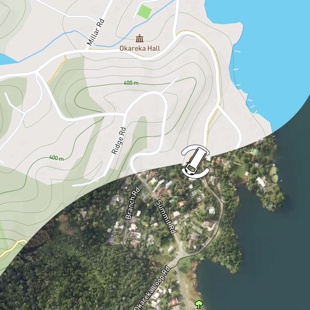
See exactly where things are in the real world with highly detailed satellite maps.
Or use some of the world's best high quality terrrain maps.
Just two of our 10 different base maps for Pro users.
Alert if someone is not home by a time.
Alert if someone enters/exist a zone.
Alert if someone goes offline.
Make sure someone using your boat/aircraft gets home safe.
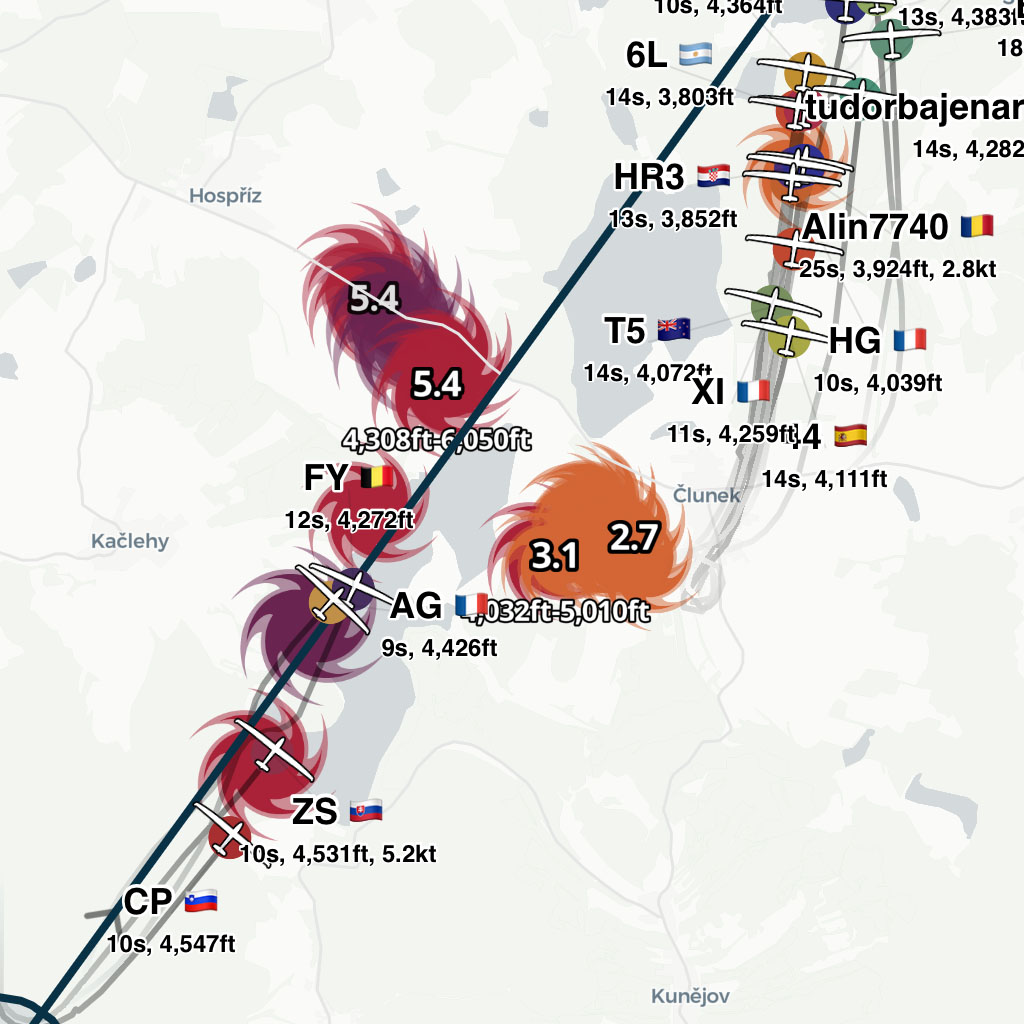
See where and how fast others are climbing ahead.
Shows live climb rates as aircraft climb.
Climb location is left on the map so you can fly right to it!
Available worldwide for all paragliders and gliders.
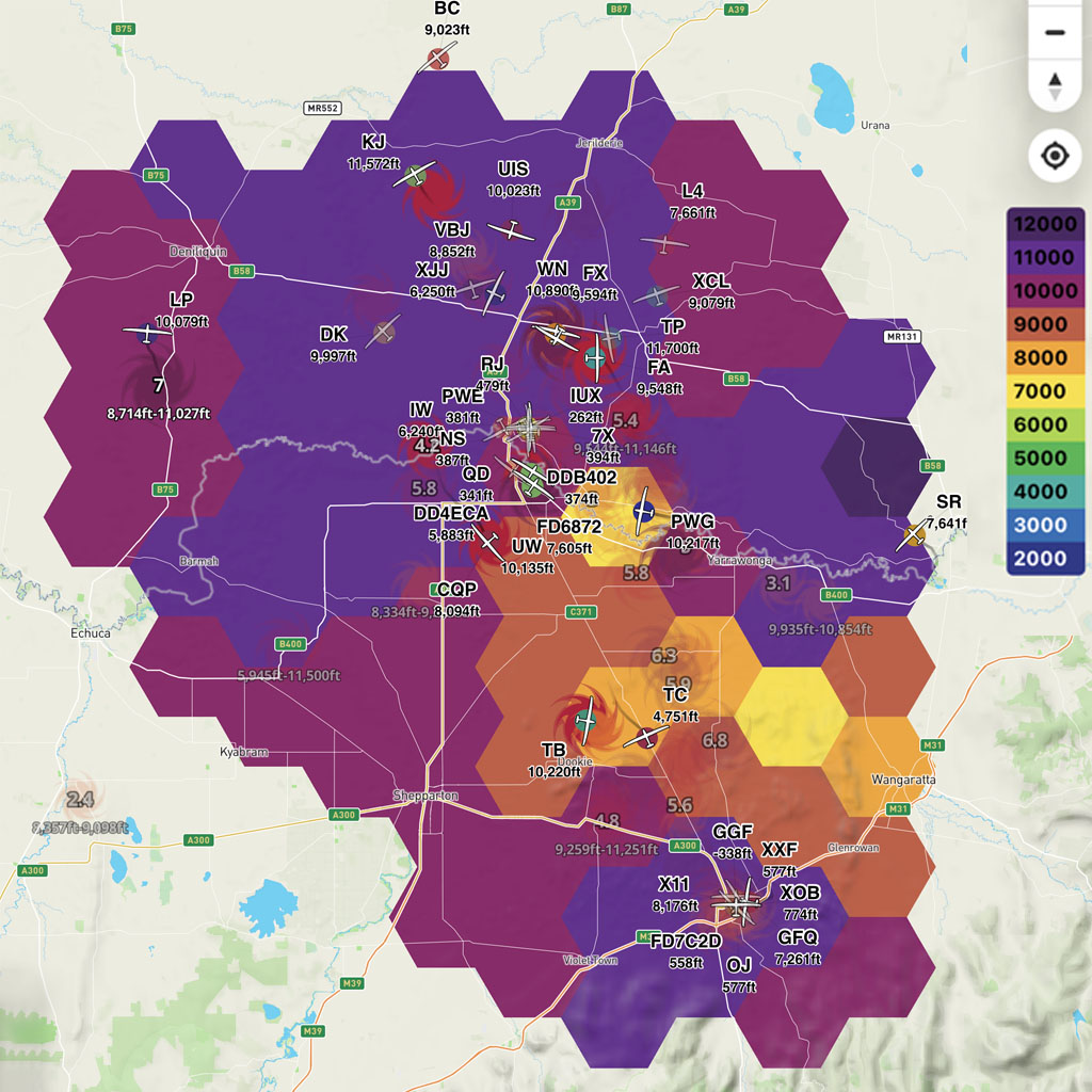
See how high people are climbing.
Check if anyone has climbed into wave.
Plan route based on better air.
Available worldwide for all paragliders and gliders.
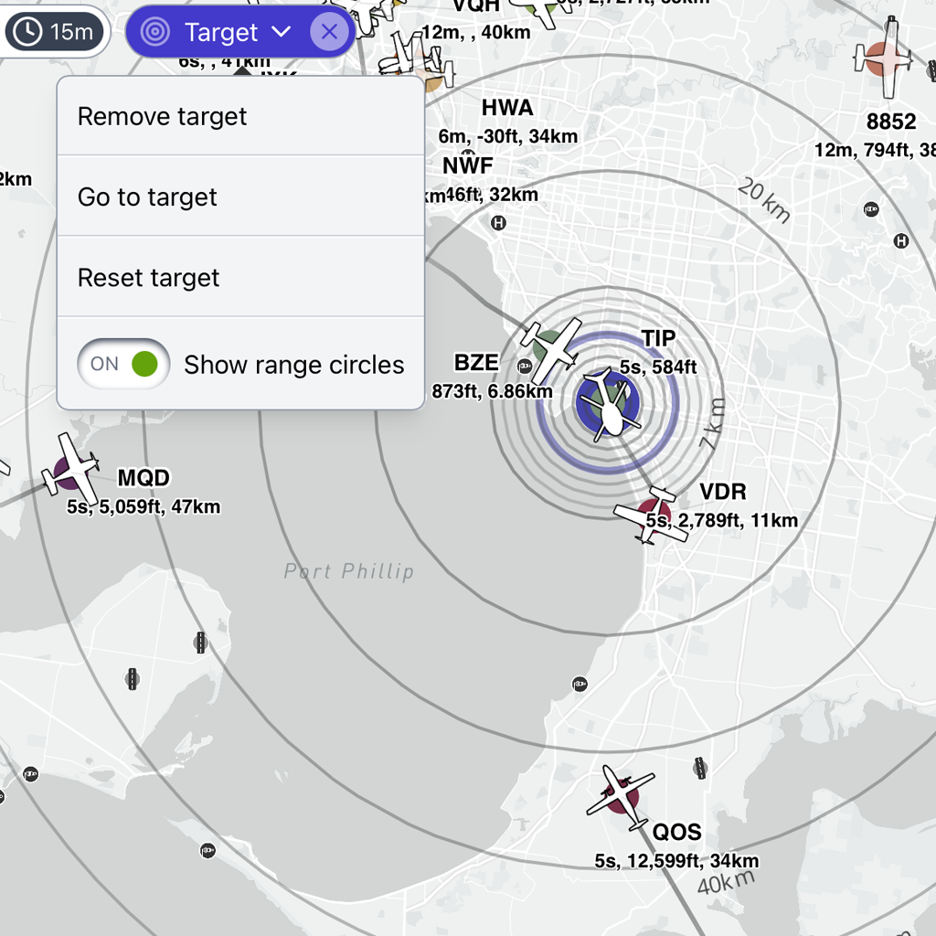
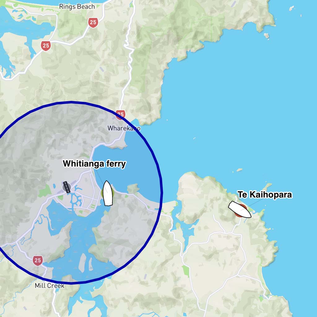
Shows 'distance to target' for all map markers.
Position anywhere on map. e.g. airport, or finish line.
Snap to aircraft for live updates as they move.
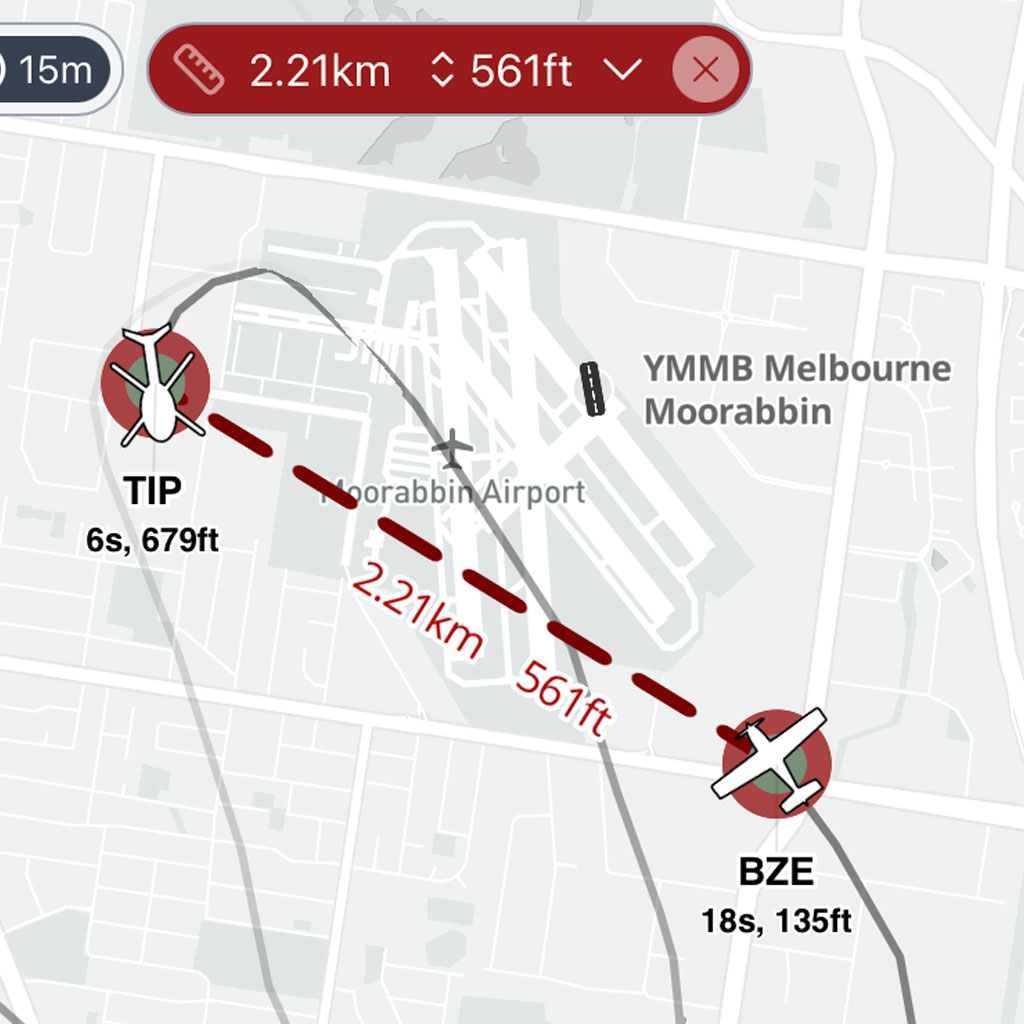
Measure distance and altitude between two points.
Snap to aircraft for live updates as things move.
Add more points for complex distances.
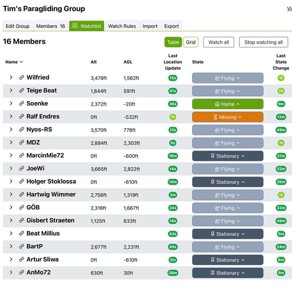
Create & manage groups
Send group invites.
Easily share a public link.
Make sure everyone gets home safe.
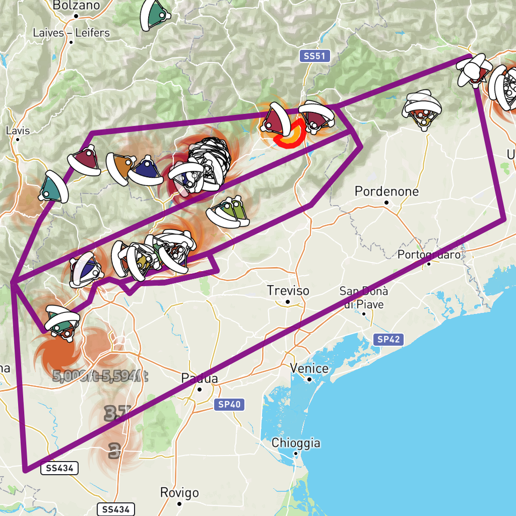
Add custom airspace to your group
Add a task to your group.
Sharing the link to your group will include the airspace and task you have configured.
| Free | Pro | Commercial | |
| Usage | Personal | Personal & Non-commercial | Commercial |
| Tracking sources | Unlimited | Unlimited | Unlimited |
| IGC download | 1 day | 30 days | 30 days |
| Track history | 1 day | 30 days | 30 days |
| OGN track history | 1 day | 1 day | 1 day |
| View multi-tracks | 2 | 40 | 40 |
| Flight history | 2 | Unlimited | Unlimited |
| Base maps | 4 | 10 | 10 |
| Satellite map | |||
| SkySight layers | |||
| Airspace layer | |||
| Gliding contests | |||
| Rain radar | |||
| Task upload/scan | |||
| Forward to OGN | |||
| Search | |||
| Live wind layer | |||
| Mountains layer | |||
| Geofence Alerts | |||
| Climb indicators layer | |||
| Climb height layer | |||
| Group Management | |||
| Group custom airspace | |||
| Target tool | |||
| Ruler tool | |||
| Track point labels | |||
| 3rd party apps | |||
| Take off/landing reports | |||
| Register | Subscribe | Contact |