We've been busy, here are the highlights of the last 6 months :) Consider upgrading to PureTrack Pro to get access to some of these awesome features, and support future development.
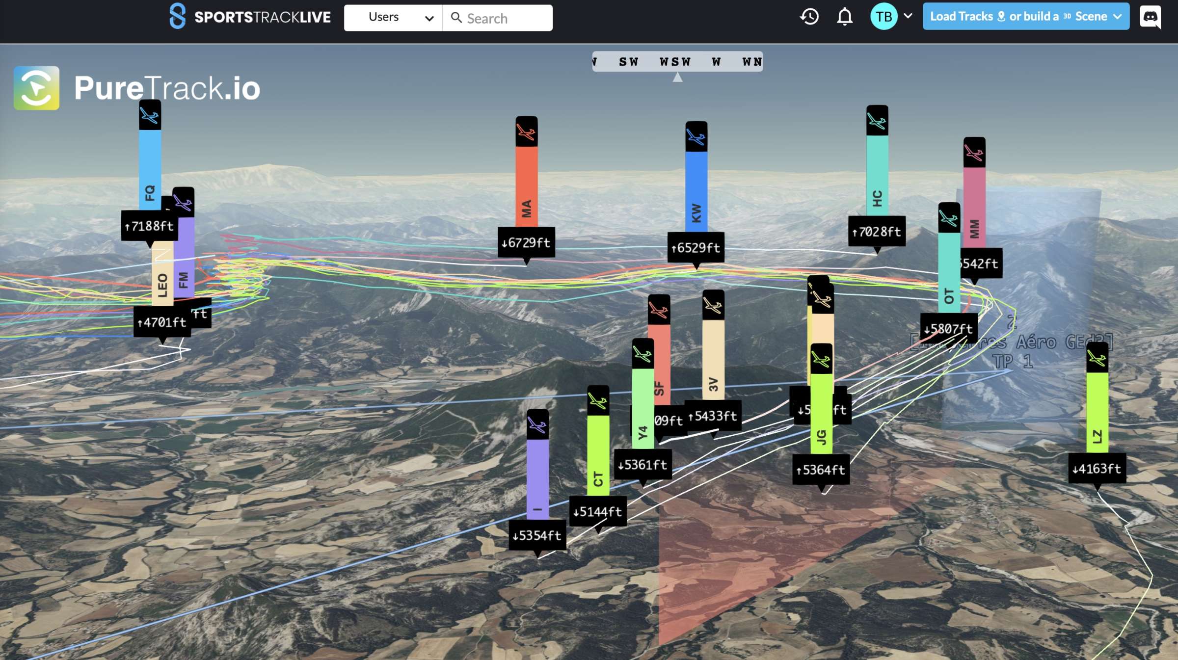
Now available for viewing individuals or groups! Tasks can be loaded automatically from SoaringSpot to watch any race in 3D, live, for free. Find in the share menu for individual map markers. Or from the group menu for groups. Free for all users. Free registration on SportsTrackLive may be required. Get in touch with us if you'd like help setting this up for your event or contest.
A big thanks to the team at SportsTrackLive for making this happen. And they have a great iOS and Android app that can send tracking data to PureTrack. Find it in your app store.
Great to check the ADSB coverage in your flying area. It will obey the altitude limit, so you can check coverage down at lower levels. Select from the 3 individual ADSB networks, or all of them.
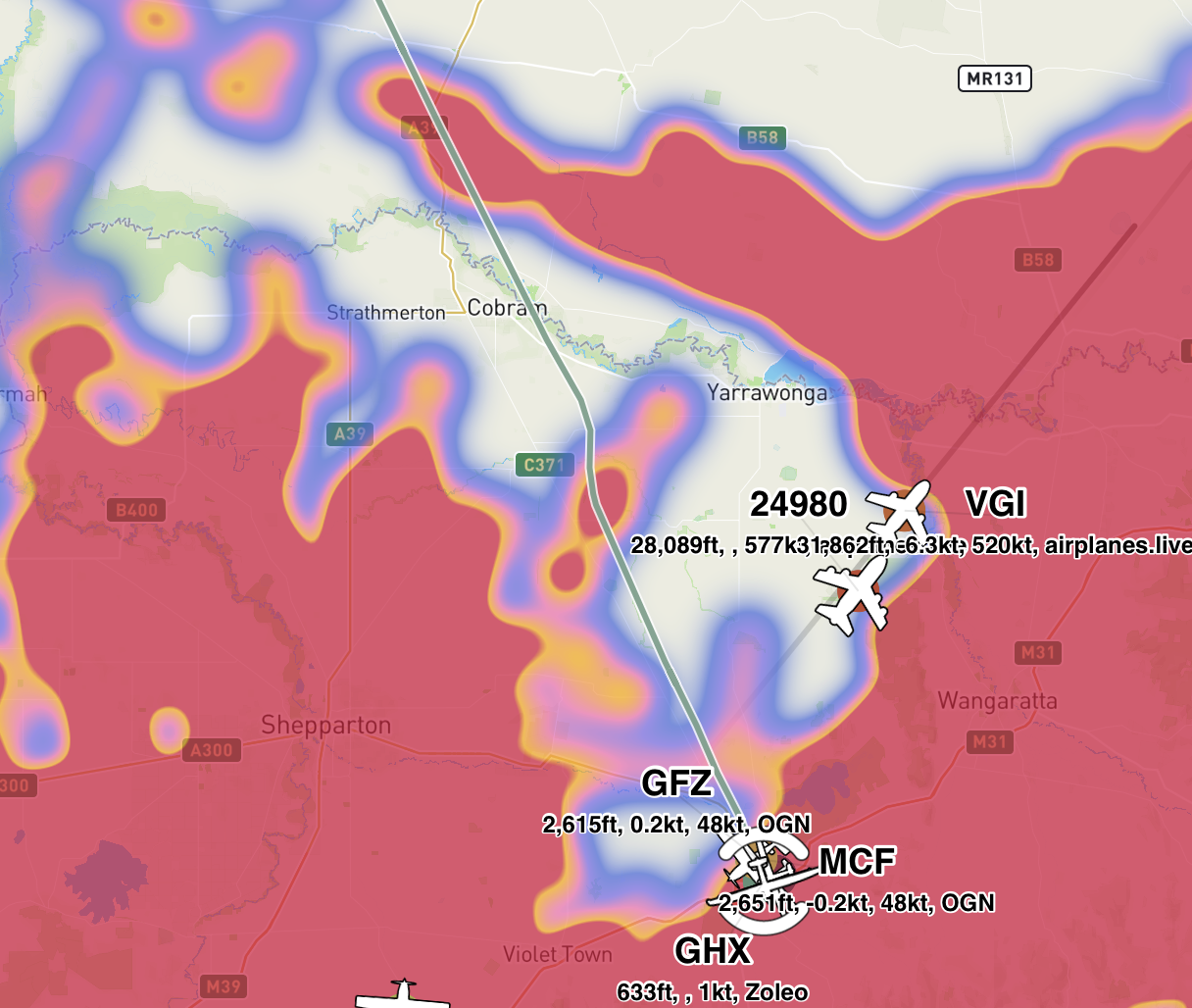
Now pulling data from airplanes.live, worldwide, every 5 seconds. See our ADSB page on how to help feed ADSB data with your own receiver.
PureTrack now stores full track data for 8 days, and basic track data for 3 months. Note OGN data is limited to 24 hours. Available for all downloads, or track viewing features.
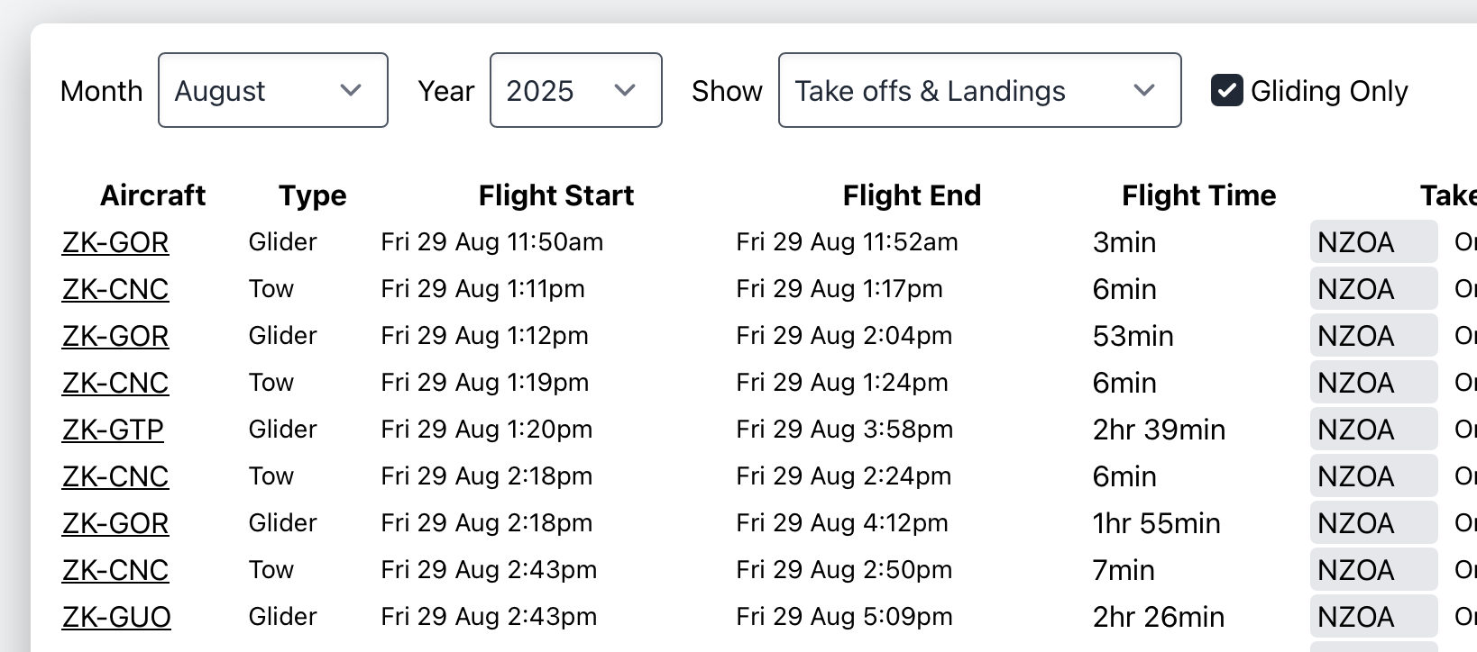
View a list of all take offs and landings at your airfield for any month of the year. Option to download as CSV. Also an option to filter to only gliders and tow planes. Currently all Pro users can view these while we develop and test this feature.
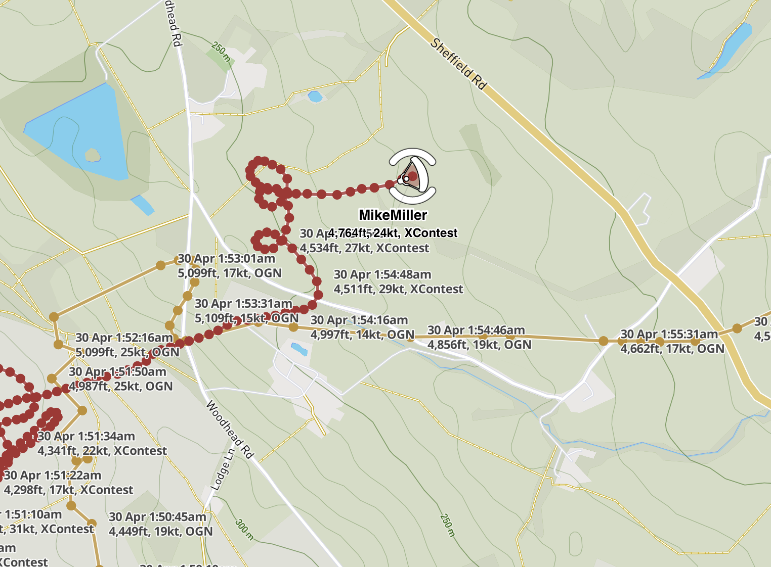
View each individual track point on the map with optional labels. Great for analysing a track point by point. The '2nd line label options' in the layers menu will change what data is shown on each point.
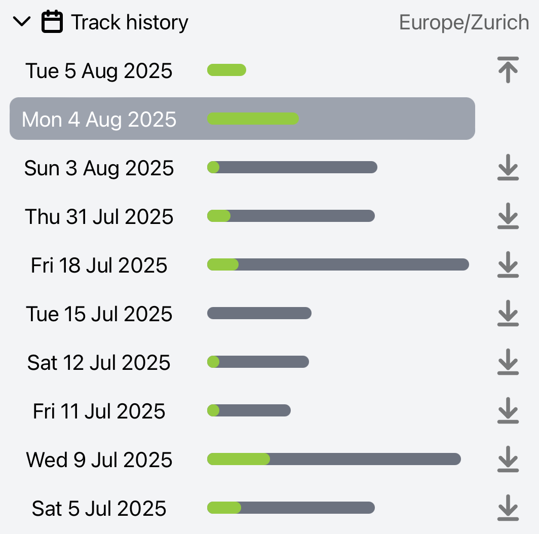
View a list of days with tracking data for any map marker. Click any day to view that day's tracks. You can also select multiple days.
Handy if automatic take off/landing detection didn't work for your aircraft, or it's not an aircraft! It shows how much data was created on each day.
Find this in the info panel for any map marker. Upgrade to PureTrack Pro to view more than 2 days of track data.
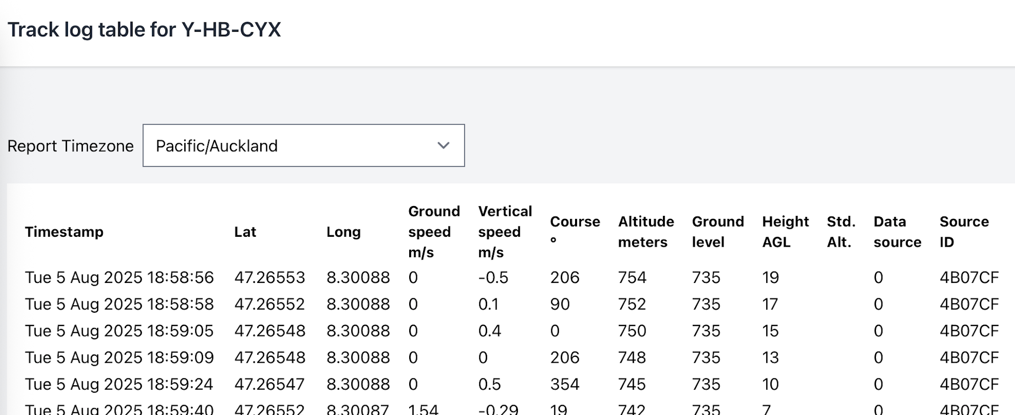
If you're analysing track data, use this page to see point by point in a table view. Find the option on the chart menu button.
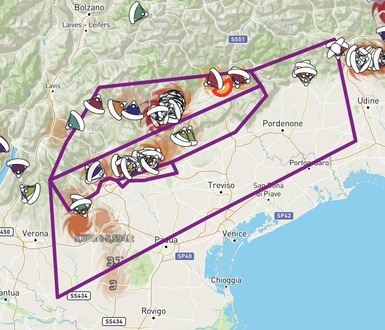
Upload your own custom airspace files, great if your event has custom airspace. Add to a group, and the custom airspace will be available for all group members. Also now configure the line width and opacity for airspace.
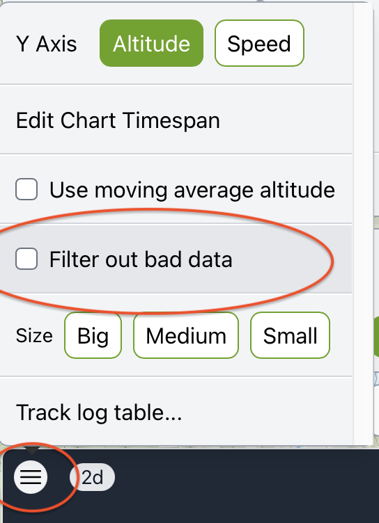
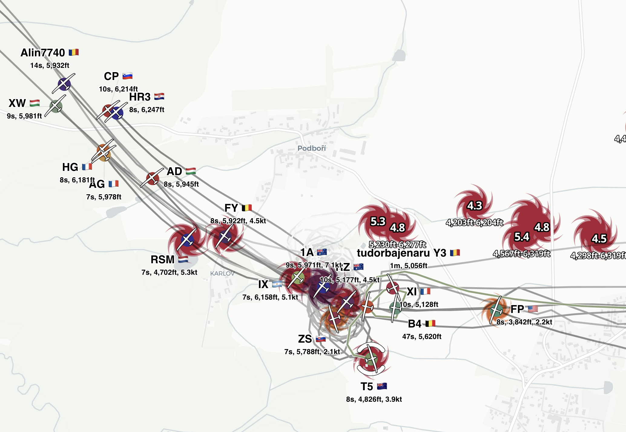
Now tracks with bad or unrealistic points (e.g. crazy speed) can have those points filtered out. This makes tracks look much better! This is optional when viewing a chart or downloading data.
A terrain map now available to all! Find it in the layers menu along with our other free and Pro base maps.
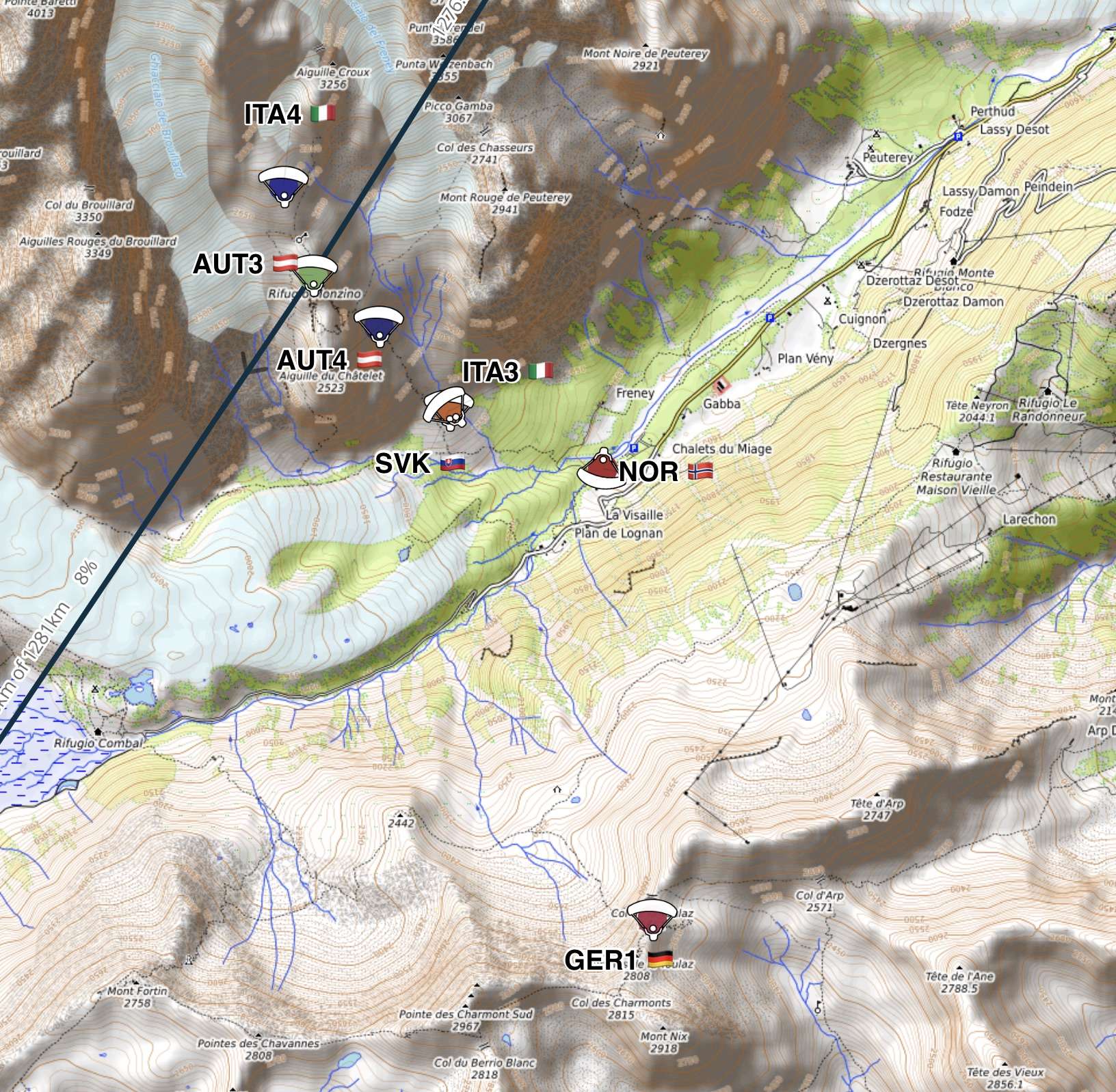
Great for international events and contests, pilots can now have their country flag beside their name/registration.
We now import names from WeGlide and SkyTraxx, making it even easier to find pilots by name.
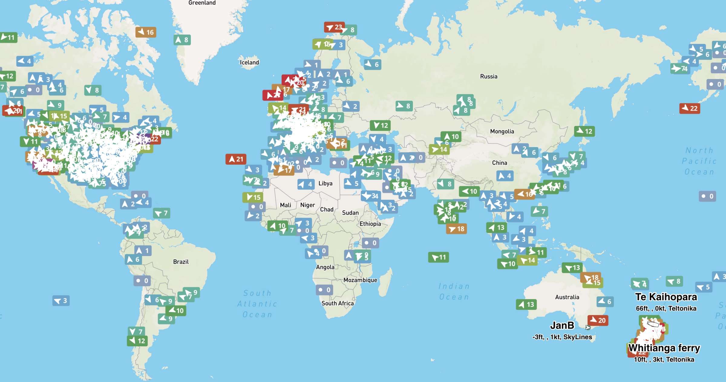
We now import weather station data from: winds.mobi, holfuy, MeteoSwiss, Open Wind Map, SLF, and aviationweather.gov. Providing live weather station data around the world!
Free for all users.
We now support XCglobe, FlyMe apps and the SKYTRAXX and Ticatag networks.
If you're a business wanting to use PureTrack data, we now have commercial plans available. Check out the details or contact us for more information.